History of the Mattole Estuary
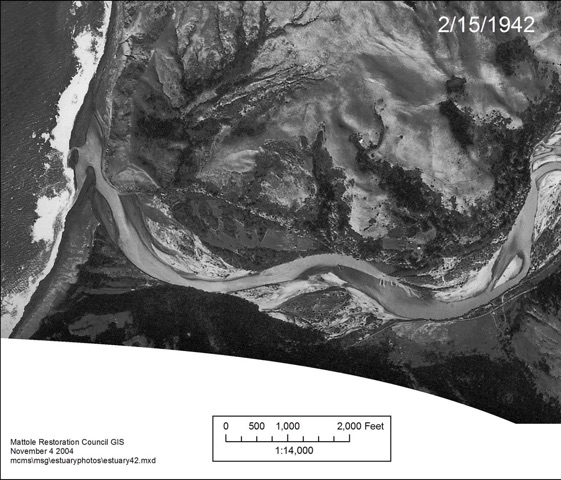
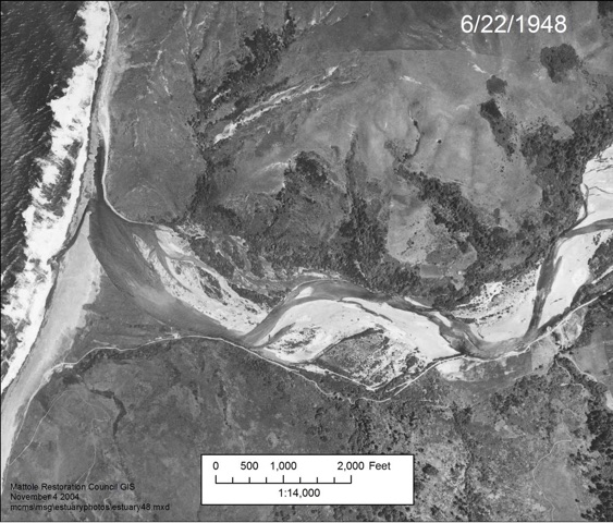
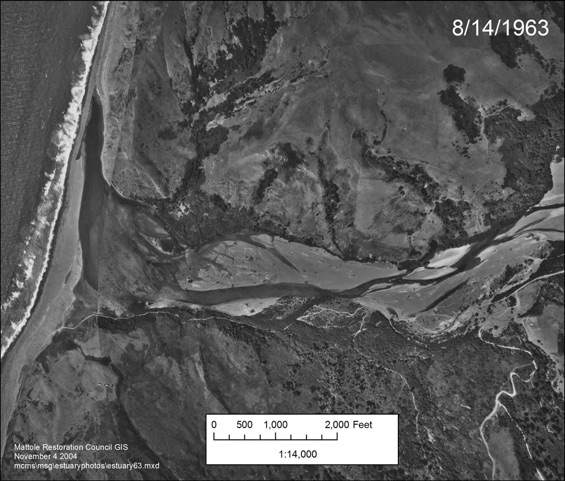
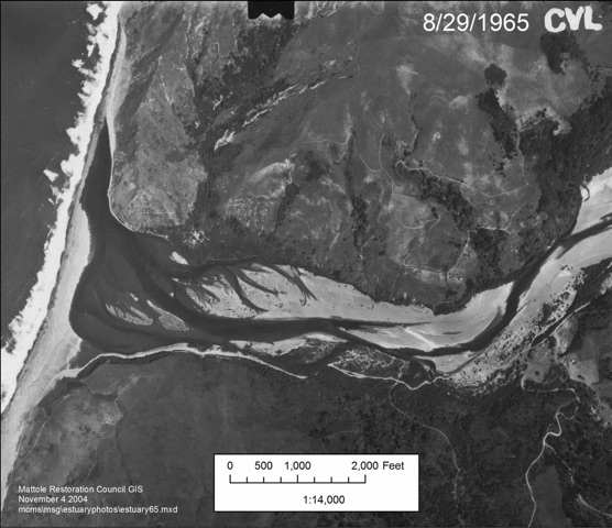
Prior to major land disturbances, the Mattole estuary/lagoon was notable for its deep, thermally-stratified pools and numerous functioning north and south bank slough channels that flushed sediments from the river and received marine water. These areas nourished and provided a stable habitat for a variety of avian, terrestrial, and aquatic species, including salmon and steelhead, which used it during summer rearing. However, land-use impacts from logging and road construction, followed by the 1964 flood, dramatically altered the estuary. The estuary was filled in with large volumes of sediment from up-slope and upstream sources, burying the once productive slough channels and estuarine habitats (check out historical aerial photos below).
Humboldt State University’s Cooperative Fisheries Research Unit studied the estuary in 1986 and 1987 (Busby et al. 1988) and found that the estuary was extremely shallow in depth (from a minimum of 0.1m to a maximum of 4m – with much of it merely ankle deep and temperatures lethal to juvenile salmonids (daily maximum temperatures ranging from 17 to 23 degrees C).
Reimers work on the Sixes River in Oregon (1971) found that juvenile Chinook who had over-summered in the estuary were far more likely to return as spawning adults, suggesting poor conditions in the Mattole estuary could be creating a bottleneck for Chinook.
MSG had proposed dredging the South Slough, then located along the ocean berm, in the early 1980s. (Note: The thalweg of the lower mainstem at the Dogleg jumped from south to north after the 1982-83 winter, contributing to the inaccessibility and infilling of the South Slough.) But at that time, the project was considered too radical an alteration of the natural environment and was not implemented. What followed were various projects to mitigate for the lack of suitable habitat for the over-summering fish.
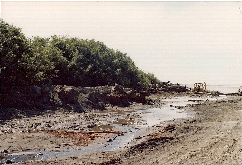
In 1989, MSG pioneered the Estuary Floating Shade and Cover Structures which the juvenile fish flocked to immediately upon placement. The following year, we built 2 log revetment structures on the South Bank and along the North Bank (see photos below). The purpose was to provide scour and habitat complexity in the hostile aquatic environment.
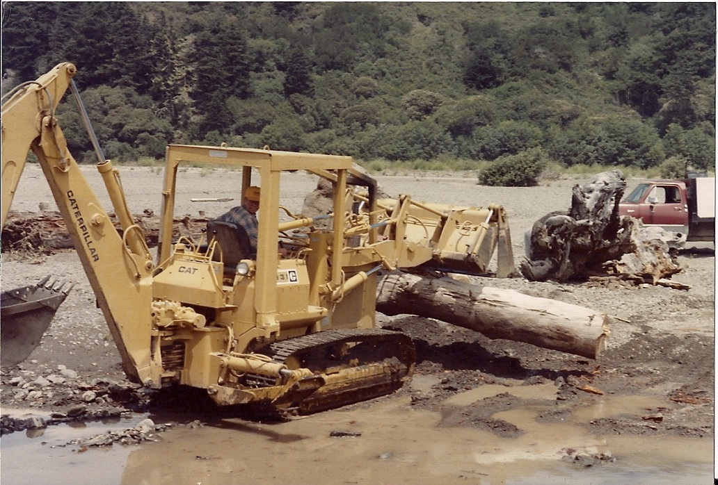
Installation of the first structures in the Mattole Estuary in progress (1990).
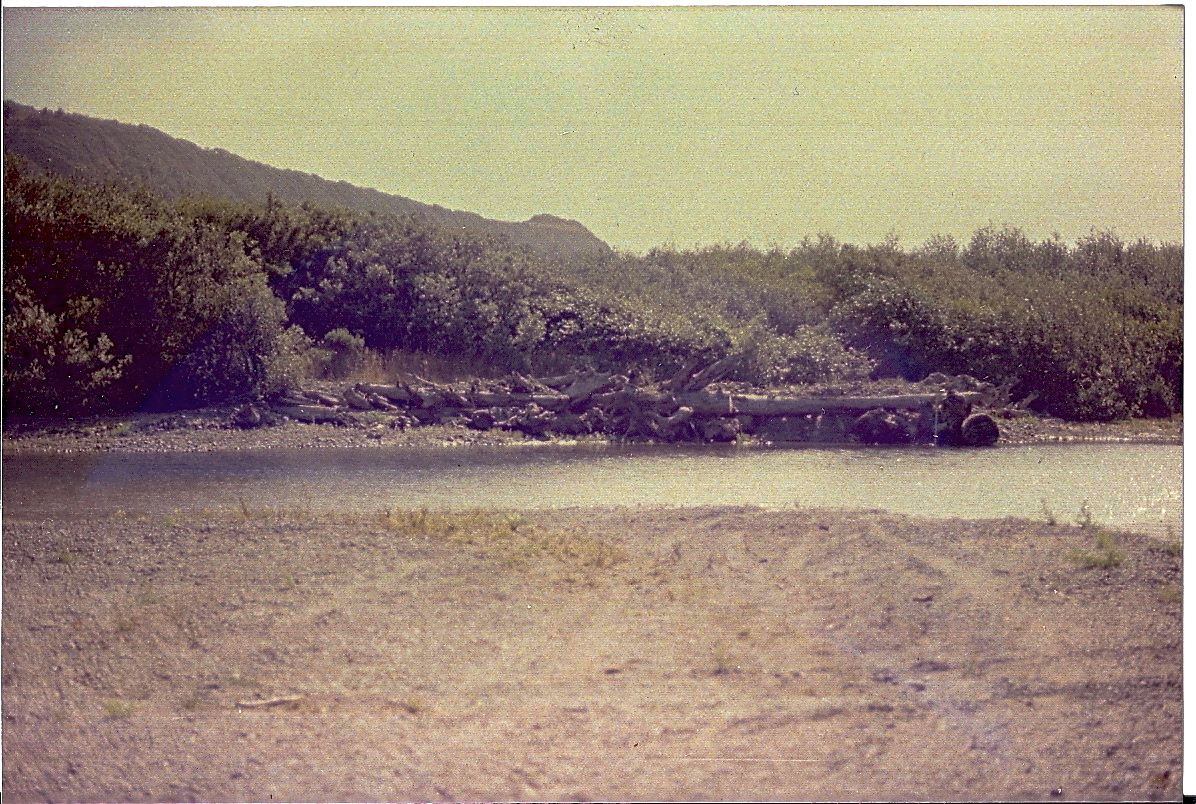
Finished view of one of the first estuary structures on the south bank, built by the MSG in 1990.
View to Ocean from first estuary structures along the south bank (built by MSG in 1990).
The South Bank structures were still in place as late as 2010 (see photo below) and most of the North Bank structures are in place today. Along with structures, MSG conducted riparian plantings from 1986 through 1994.
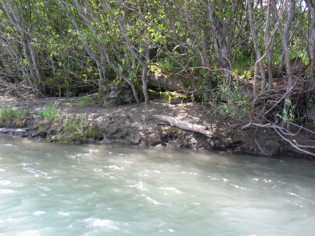
1990 Estuary Structures still in place along the south bank in 2010.
During this time, MSG convened a meeting with the California Department of Fish and Game, Coastal Conservancy and the USDA Redwood Sciences Laboratory to propose studying the Mattole estuary and developing a plan to restore aquatic function to that bottleneck for Chinook as well as coho. Funding was provided and the Mattole Restoration Council was contracted to complete the study, Dynamics of Recovery, 1995
Provided in Dynamics was a plan to place more log and rock anchored structures in the estuary but to build them larger and heavier and closer to the high-energy flows so that they would scour deeper and provide better habitat.
Learn more about Restoration Projects in the Mattole Estuary.
While the estuary gained depth, complexity and improved conditions for juvenile salmonids from the late 1990s on, the South Slough never regained connection with the river. The habitat determined so beneficial to salmonids which pass through the estuary was still not present. It became evident in the late 1990s that when in 1974 the tributaries that drained the south valley wall (Stansberry and Lower Bear Creeks) were channelized and directed into the mainstem, the South Slough was deprived of flushing flows which could have maintained its connection with the estuary. Further complicating connection, the South Slough (and the entire estuary area) had been elevated by the 1992 earthquakes, perhaps close to 1m. MSG began investigations to get Lower Bear back into its pre-1974 channel, but to lead it through the riparian terrace to a remnant slough just upstream of the old South Slough. Further investigation showed that one could work at both ends of that system, and in 2014, 250 linear feet were excavated at the confluence of the slough and the mainstem. Shortly following completion, 4 adult Summer Steelhead were found to use the new habitat – an indication that it provided preferred off-channel habitat for the dominant anadromous species.
Today the estuary is poor habitat for all salmon and steelhead species: the water is too warm, habitat cover is poor, and the channel lacks riparian vegetation, and therefore should be a focal point in reducing limiting factors for salmonids in the entire watershed (Downie et al. 2002).
-
Mattole Estuary 1942

-
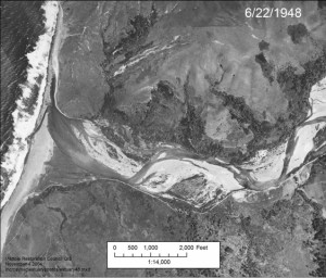
Mattole Estuary 1948
-
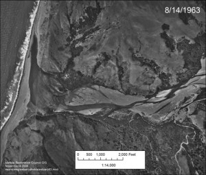
Mattole Estuary 1963
-
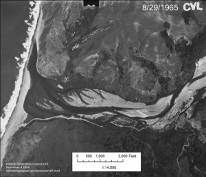
Mattole Estuary 1965
-
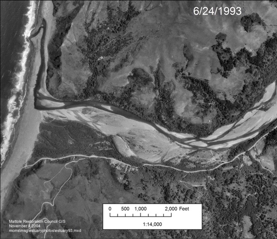
Mattole Estuary 1993

-
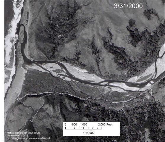
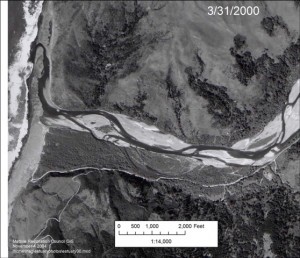
Mattole Estuary 2000
References: